HISTORY
The history of Karaağaç constitutes an integral part of Anatolian history. Throughout various eras, the region came under the rule of the Hittites, Phrygians, Ionians, and Lydians, followed by the Persians, Macedonians, Seleucids, Romans, Arabs, Seljuks, Hamitoğulları Principality, and finally the Ottoman Empire. During these transitions, Şarkikaraağaç was also incorporated into the dominions of these civilizations.
Historically, the district has been known by various names such as Khillarnion, Pedion, Anabura, Neapolis, Asikale, Karaağaç, Karaağaç-ı Yalvaç, and Karaağaç-ı Şarki. The name Karaağaç (“Elm Tree”) is believed to originate from the presence of a large elm tree around which the first settlement was founded. To distinguish it from other localities with the same name, the term Şarki (“Eastern”) was later added.
Under Byzantine rule, the area was subject to Turkish incursions. It came under the control of the Seljuks during the reign of Sultan Kılıçarslan III, son of Rükneddin Süleyman Şah, in 1203. After the death of Kılıçarslan, Gıyaseddin Keyhüsrev III ascended to the throne in 1264 and ruled until 1281. During his reign, the Grand Mosque (Ulu Cami), also known as Camii Kebir, was constructed. The inscription on the western window of the mosque provides valuable historical information, indicating that during that period, the Seljuk realm was divided between Gıyaseddin Keyhüsrev and Gıyaseddin Mesud.
Subsequently, Karaağaç came under the influence of the Hamitoğulları Principality, specifically within the Isauria region. Following the division of the Hamitoğulları, Karaağaç remained under the rule of Dündar Bey’s descendants. Due to its geographical position, the area was later influenced by the Eşrefoğulları, Germiyanoğulları, and Karamanoğulları principalities. During the rule of İlyas Bey, the region was temporarily occupied by Alaaddin Bey of the Karamanoğulları. However, in 1380, İlyas Bey’s son Kemaleddin Hüseyin Bey concluded an agreement with Ottoman Sultan Murad I, ceding Isparta, Yalvaç, Akşehir, Beyşehir, Seydişehir, and Karaağaç to the Ottomans in exchange for eighty thousand gold coins. Thus, Ottoman sovereignty over the region was established.
During the Ottoman period, Karaağaç developed into a cultural center, housing three madrasahs (Islamic schools) and producing notable scholars, politicians, and artists. It is known that the “Saçıkara” Turkish tribe settled in the region during the 13th century. Following its incorporation into the Ottoman Empire, upon public request, Sultan Mehmed the Conqueror ordered the construction of the Alcıklar Fountain and the restoration of the Grand Mosque. The great elm tree that gave the town its name once stood near the present-day public bath (Belediye Hamamı).
Karaağaç actively participated in the Turkish War of Independence, contributing both materially and spiritually. Following the Sivas Congress, one of the first local resistance groups (Kuva-yi Milliye) was established here. Initially a subdistrict (nahiye) of Yalvaç under the name Yalvaç Karaağaç, Şarkikaraağaç gained district (ilçe) status in 1863, which it has retained since the Republican era.
NATURAL STRUCTURE
Şarkikaraağaç is bordered by Beyşehir to the south, Yalvaç, Akşehir, and Doğanhisar to the north, Gelendost and Eğirdir to the west, Hüyük to the east, and Yenişarbademli to the northwest. The district covers an area of 1,232 km². It is surrounded by the Sultan Mountains to the northeast, Anamas Mountains to the west, and the Central Taurus range, Karadağ, and Kızıldağ to the south.
The district is located on a fertile plain, with the most productive agricultural lands found around Çiçekpınar and Göksöğüt villages. A portion of Lake Beyşehir also lies within the district boundaries. The region’s climate is transitional between Mediterranean and continental, though it leans toward the latter—hot and dry in summer, cold and wet in winter.
CULTURE
Anabura (Ancient City): Located near Salur Village in the area known as Enevre, this ancient Pisidian city contains remnants of a theater, fortifications, and other buildings.
Several archaeological mounds (höyük) have been identified in the district, including Nudra Höyük near Göksöğüt, Örenköy Höyük, Beyköy Höyük, Ördekçi Höyük, Karaçayır I-II Höyük, Salur Höyük, Armutlu Höyük, Karakaya Höyük, Çavundur Höyük, and Arak Höyük, all of which are under official protection. These mounds date back to the Early Bronze Age, with pottery fragments confirming their antiquity.
Grand Mosque (Cami-i Kebir): Located at the center of Şarkikaraağaç, this mosque—constructed in 1281 by Ömer bin Ali during the reign of Sultan Gıyaseddin Keyhüsrev III—has undergone several restorations, notably in 1455 by the order of Sultan Mehmed the Conqueror.
Alcıklar Mosque: Originally built under the order of Sultan Mehmed the Conqueror, the old stone mosque was replaced by a new structure completed in 1971, now known as Fatih Sultan Mosque or Alcıklar Mosque.
POPULATION
Initially a subdistrict of Yalvaç, Şarkikaraağaç became a district of Konya in 1863, and in 1878, it was reassigned to Isparta Province along with Yalvaç. As of the 1990 census, the district center had a population of 12,239, with three towns (Çarıksaraylar, Çiçekpınar, Göksöğüt) and 25 villages, totaling approximately 40,000 inhabitants. The town center comprises seven neighborhoods: Alcıklar, Aşağı Kale, Asikale, Cami Kebir, Ulvikale, Fatih, and Orta.
LOCAL ADMINISTRATION
The district includes four municipalities: Şarkikaraağaç, Çarıksaraylar, Çiçekpınar, and Göksöğüt.
-
Şarkikaraağaç Municipality, founded in 1863, maintains various public buildings, commercial spaces, and service vehicles.
-
Çarıksaraylar Municipality was established in 1955, with a population of 4,779, and offers modern municipal services including a town hall, public bath, wedding hall, and workshops.
-
Çiçekpınar Municipality, established in 1971, has a population of 3,672.
-
Göksöğüt Municipality, established in 1972, has a population of 3,951 and operates public facilities such as a health center and library.
EDUCATION
According to the 1903 Education Yearbook (Maarif Salnamesi), Şarkikaraağaç had six madrasahs serving 436 students. The district has maintained a strong educational tradition through the Republican era.
By the 1994–1995 academic year, there were 27 primary schools and 8 elementary schools, educating 4,300 students with 216 teachers. The district also hosted two general high schools, a Vocational High School for Boys (Industrial), a Girls’ Vocational School, an Imam Hatip School, and a newly established Anatolian High School.
The Public Education Center and Evening Art School offer vocational courses, and there is a Vocational Training Center within the industrial zone. Dormitories associated with the vocational schools provide accommodation for students from nearby villages.
The District Public Library, dating back to the Seljuk period, today houses around 28,000 volumes and operates three branch libraries in Çarıksaraylar, Çiçekpınar, and Göksöğüt.
HEALTH SERVICES
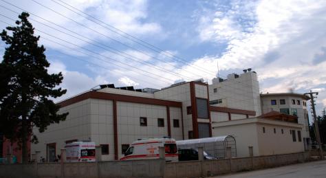
The District State Hospital, founded in 1954, has a capacity of 100 beds. In addition, there are 7 health centers located in the district center and nearby towns and villages, along with 10 village health houses providing primary care under regional supervision.
TRANSPORTATION
Şarkikaraağaç lies 120 km from Isparta and 157 km from Konya, with reliable road access to all surrounding towns and villages. The nearest settlements include Çiçekpınar (5 km) and Beyköy (5 km), while the farthest is Gedikli Village (30 km).
ECONOMY
The local economy is primarily based on agriculture and animal husbandry, with carpet weaving serving as an additional income source. The Şarkikaraağaç Irrigation Project, initiated in 1986 by the State Hydraulic Works (DSİ), aims to irrigate 13,783 hectares of land using water from Lake Beyşehir, marking one of the largest irrigation projects in Isparta Province.
The district also hosts barite mining operations, managed by Başer Mining Industry, as well as medium-scale enterprises such as a flour mill, nail factory, and stone and sand quarries.
TOURISM
The district possesses significant tourism potential due to its archaeological sites, natural beauty, and clean air. Notable attractions include:
-
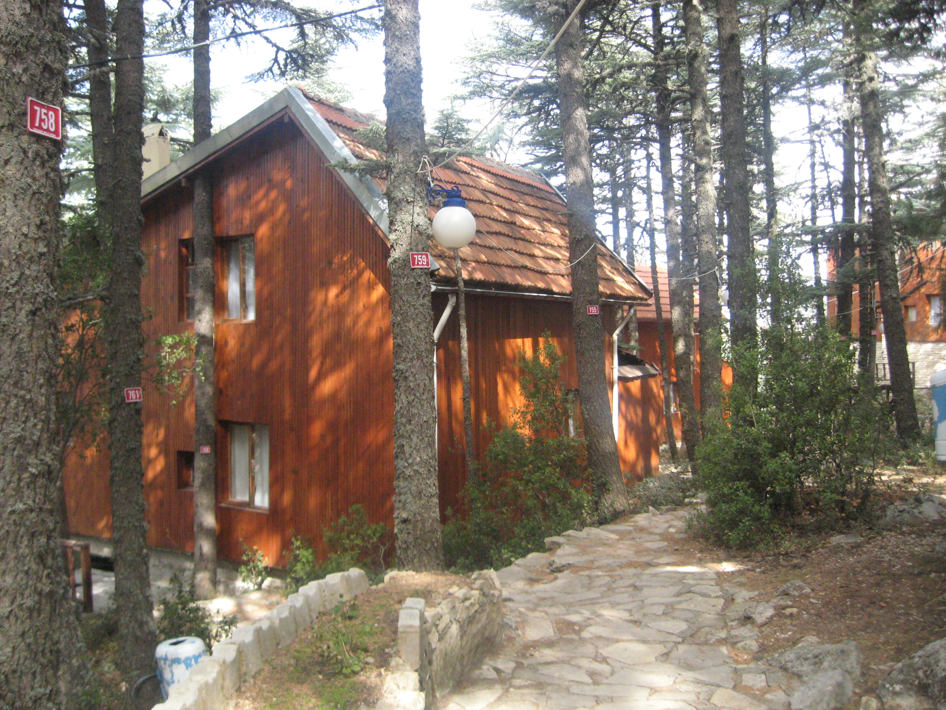
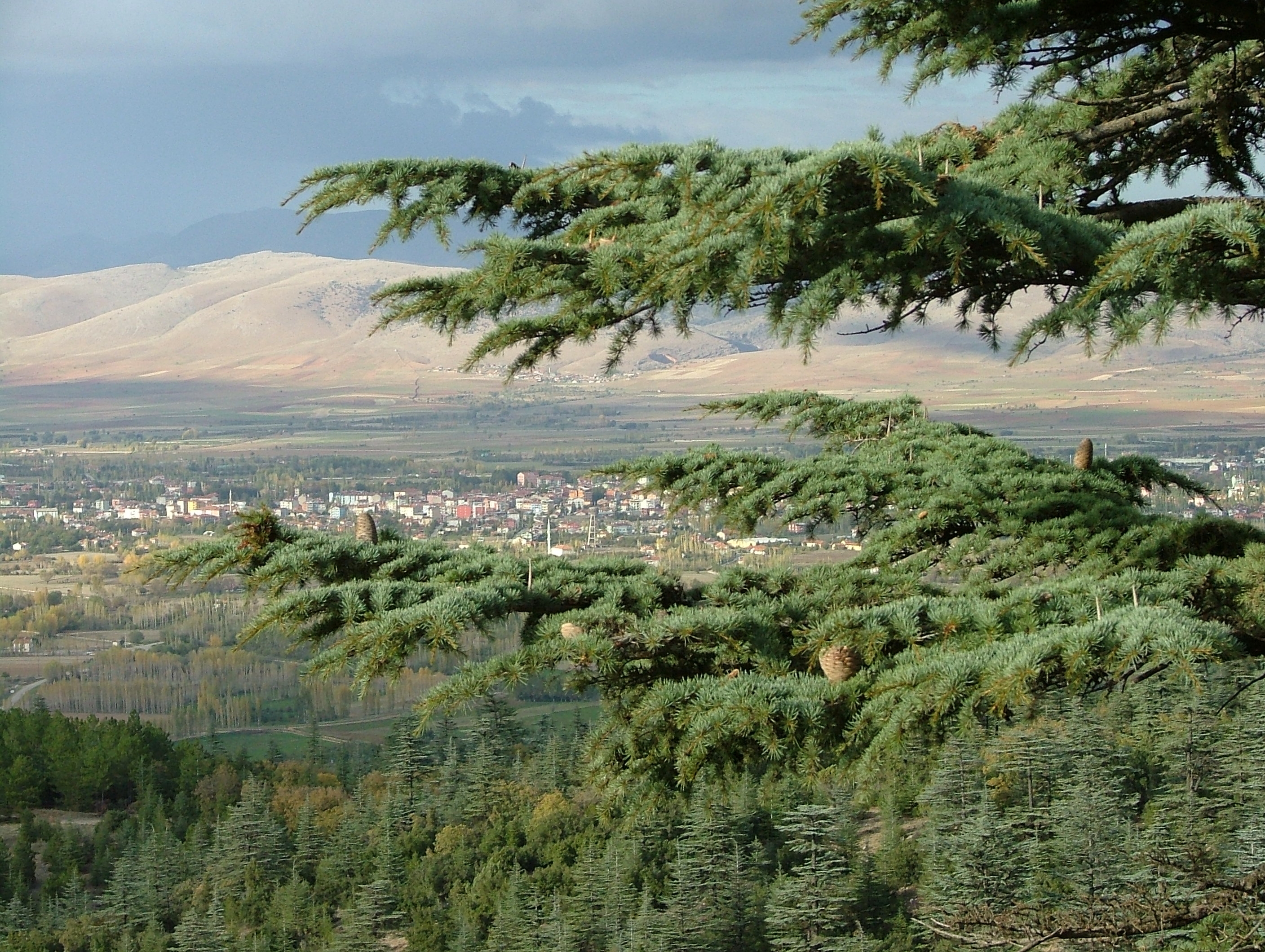
Kızıldağ National Park: Located 8 km south of the district at altitudes ranging from 1,180 to 1,840 meters, covering 631 hectares of land. It features dense cedar forests, camping areas, and mountain lodges. The area is noted for its oxygen-rich air, believed to be beneficial for respiratory ailments.
-
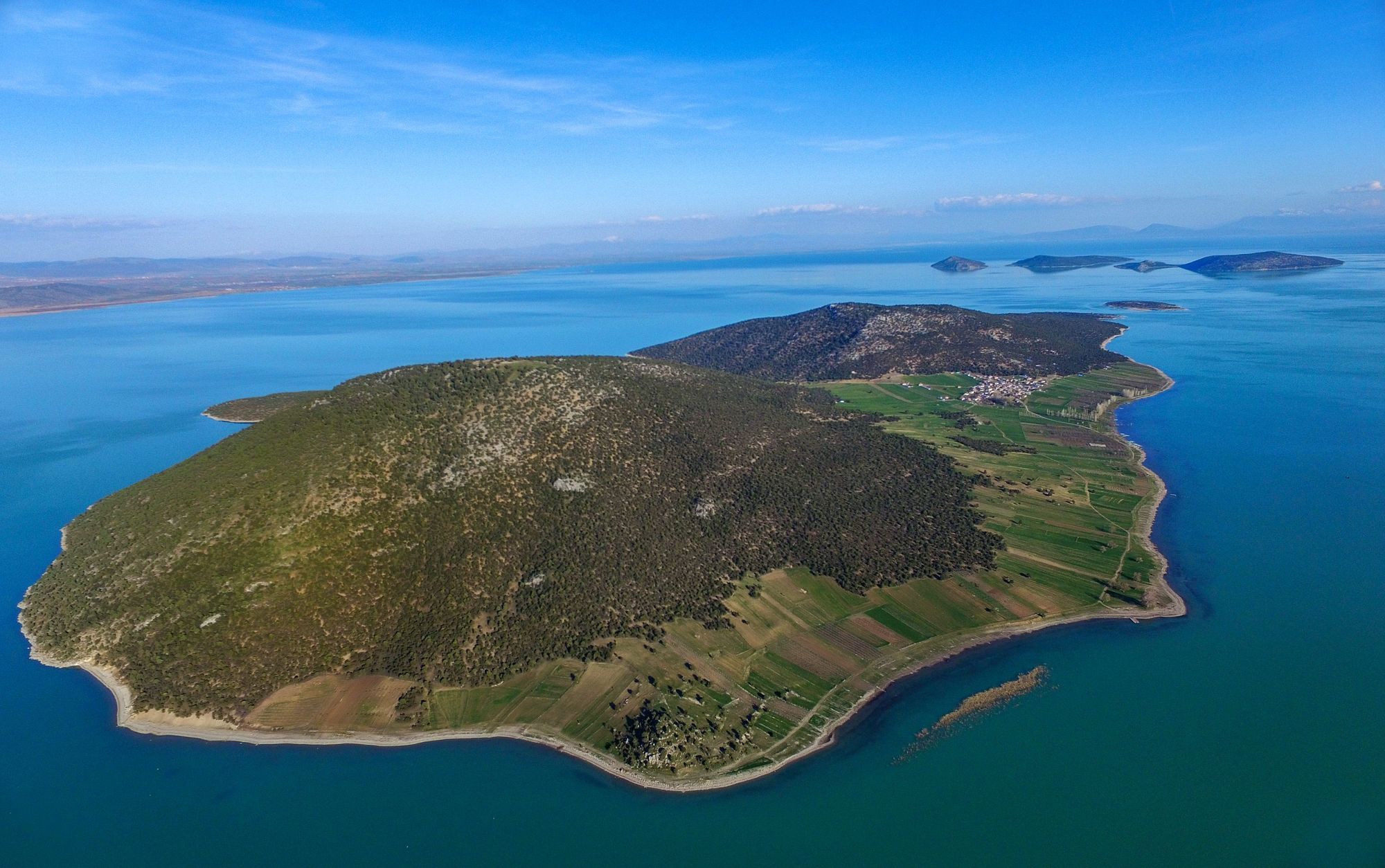
Lake Beyşehir: Partly within district boundaries, 20 km from the town center. It offers recreational facilities and supports fish species such as carp and bass, and bird species including wild ducks and cormorants.
-
Arak Cave: Located 4.5 km from the district center, this cave features impressive stalactites and stalagmites, and serves as an attractive site for spelunking and picnicking